Explore offroad trails across the country with live conditions posted by people who just ran them — and the only offroad app where every trail’s difficulty is rated by the drivers who just did it. Plan multi-day trips with your crew and navigate in 2D or 3D, all available offline.
Live conditionsCommunity ratedAvailable offlineNo ads
Free to download and explore. Landroamer Pro is $29.99/year — offline maps, navigation, crew trips, and alerts.
Length
mi
Est
h
Gain
ft
291
Trails mapped
2,401
Miles mapped
74
Towns mapped
iOS + Android
Available now
What's inside
Built for the part the pavement doesn't cover.
Every trail in Landroamer is verified by the community and run by real offroaders who share current conditions, difficulty, and what actually happened out there — in real time. Here's what you get on top of that.
Live from the trail — real posts, real roamers
Explore
Find the perfect adventure.
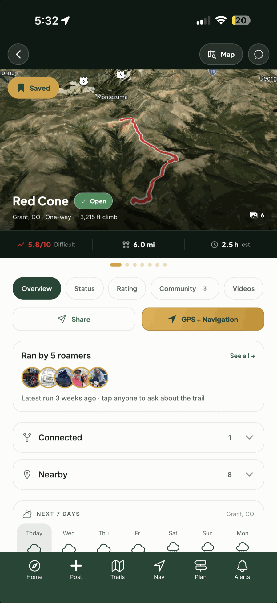
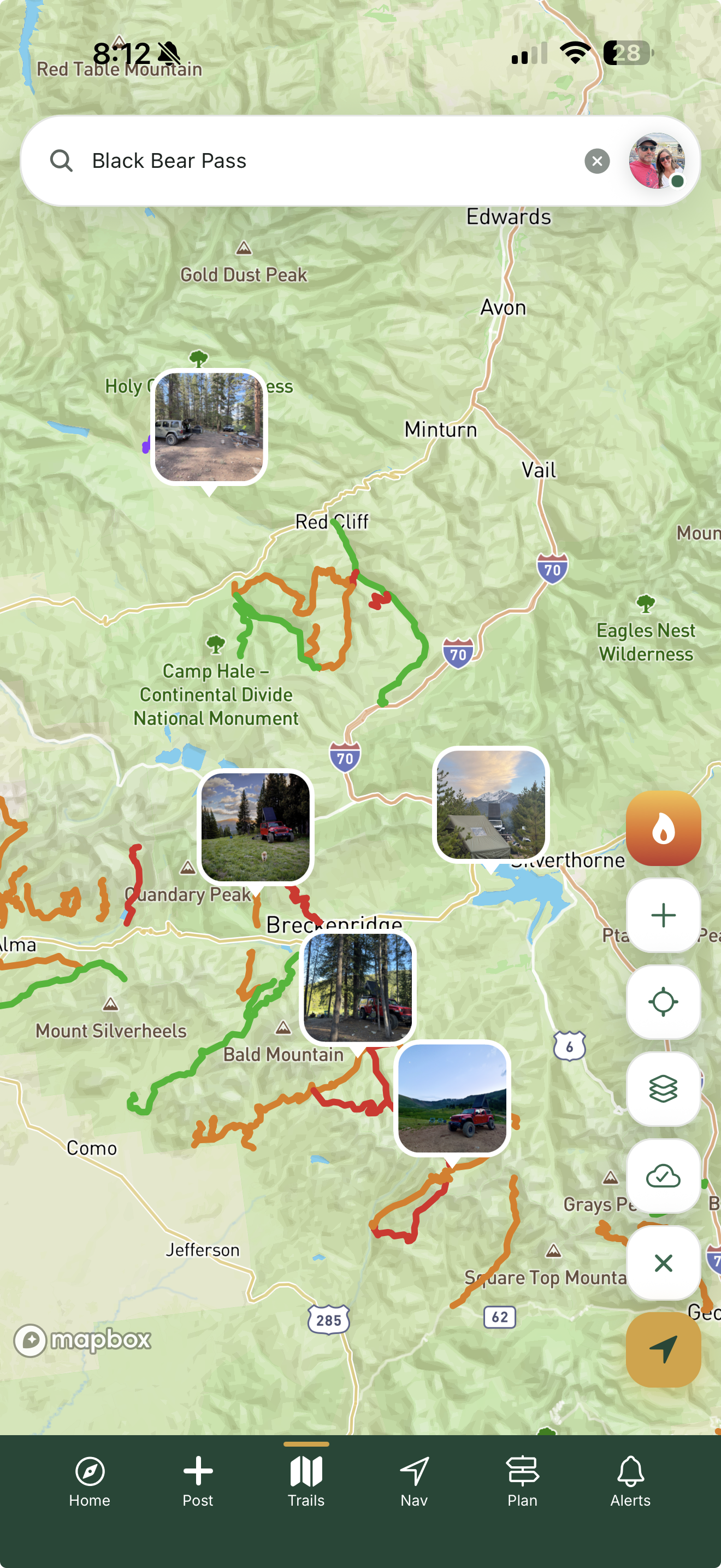
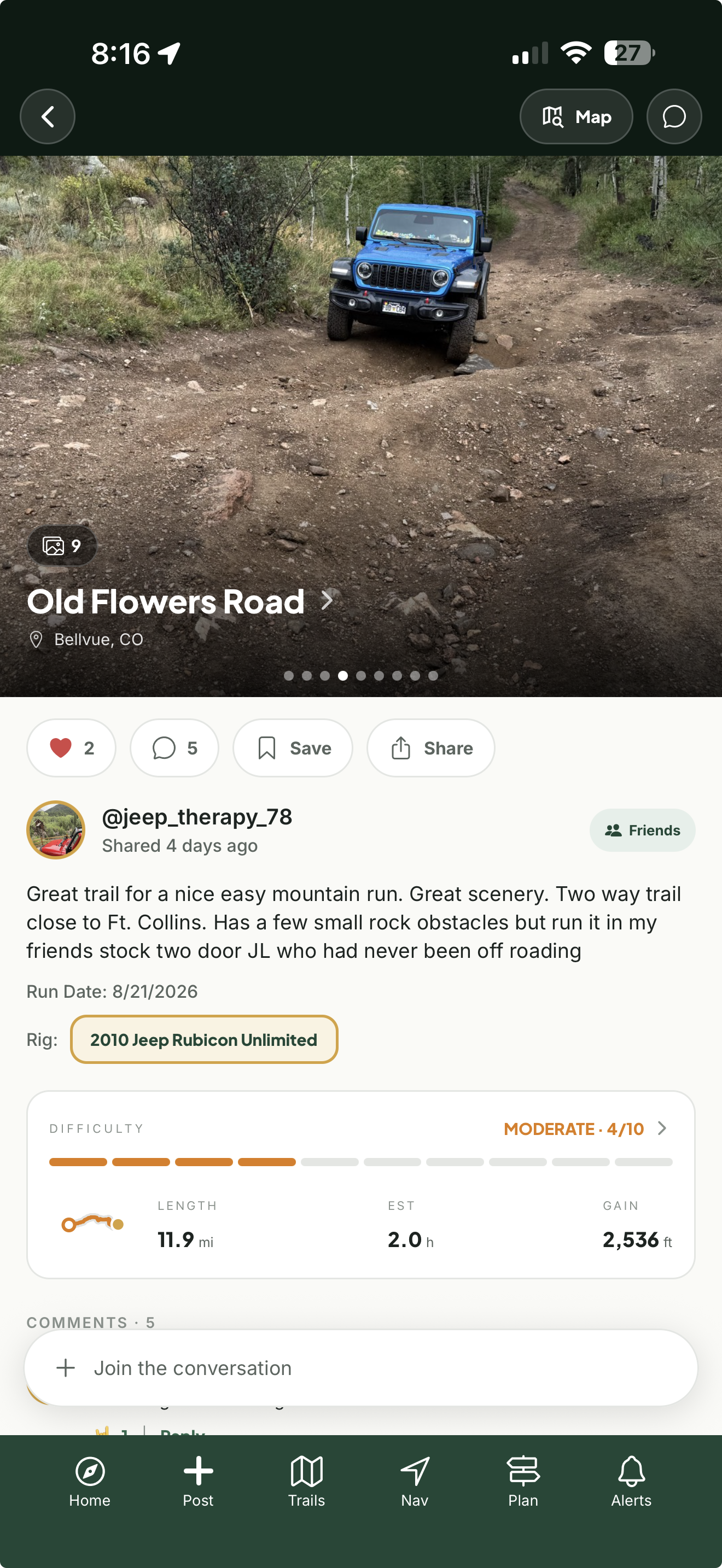
Browse the full catalog by difficulty, region, or what's near you right now. Every trail page carries the full route, one-tap Google Maps directions to the trailhead, on-trail navigation, the current status as reported by the last driver through, trailhead weather, and the photos, posts, and comments of people who just ran that exact trail — and if you have questions, message them directly.
Filter by difficulty, state, and distance from you
Message anyone who recently ran it — straight from the trail page
Status and trailhead weather from the last run, before you commit
Screenshot 01Trail list / explore map with filter chipsexplore-list.png
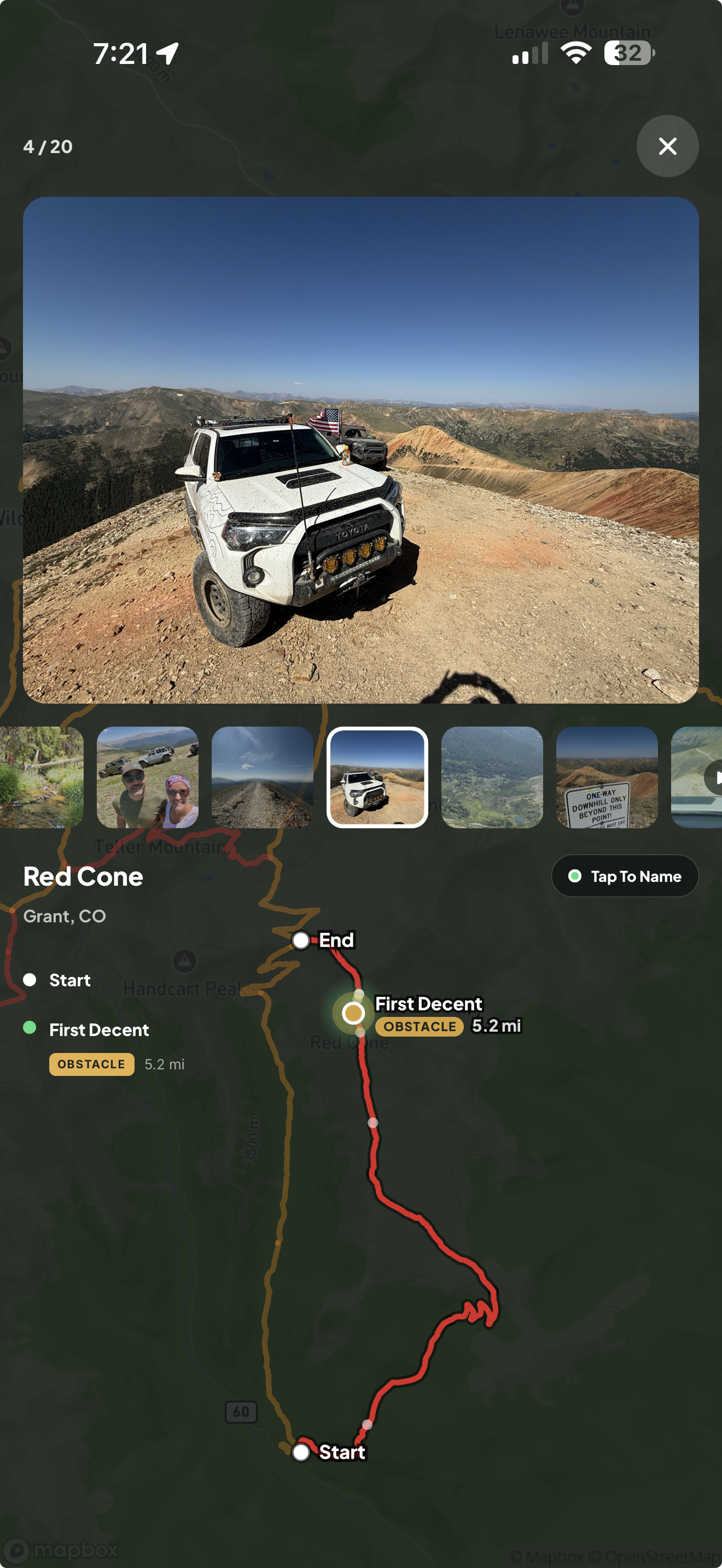
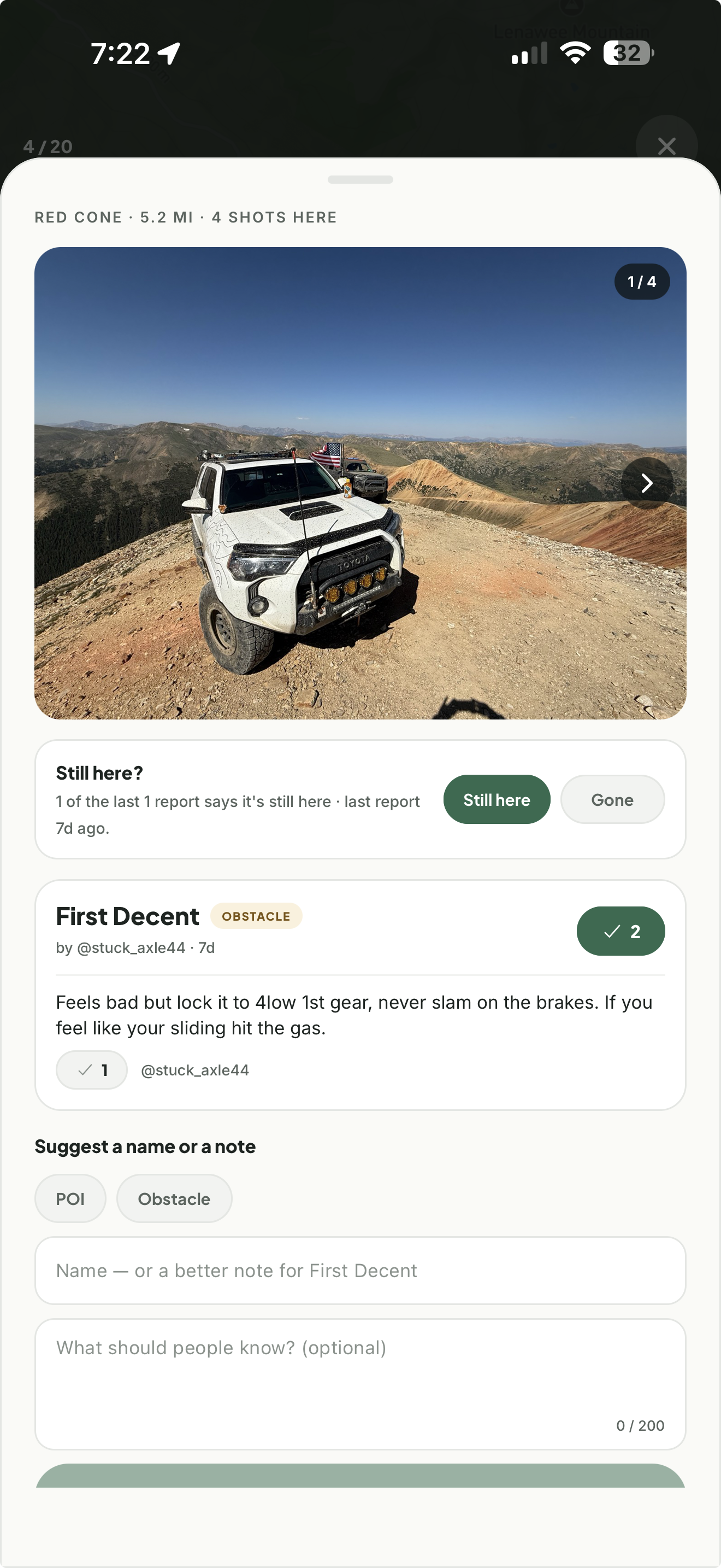
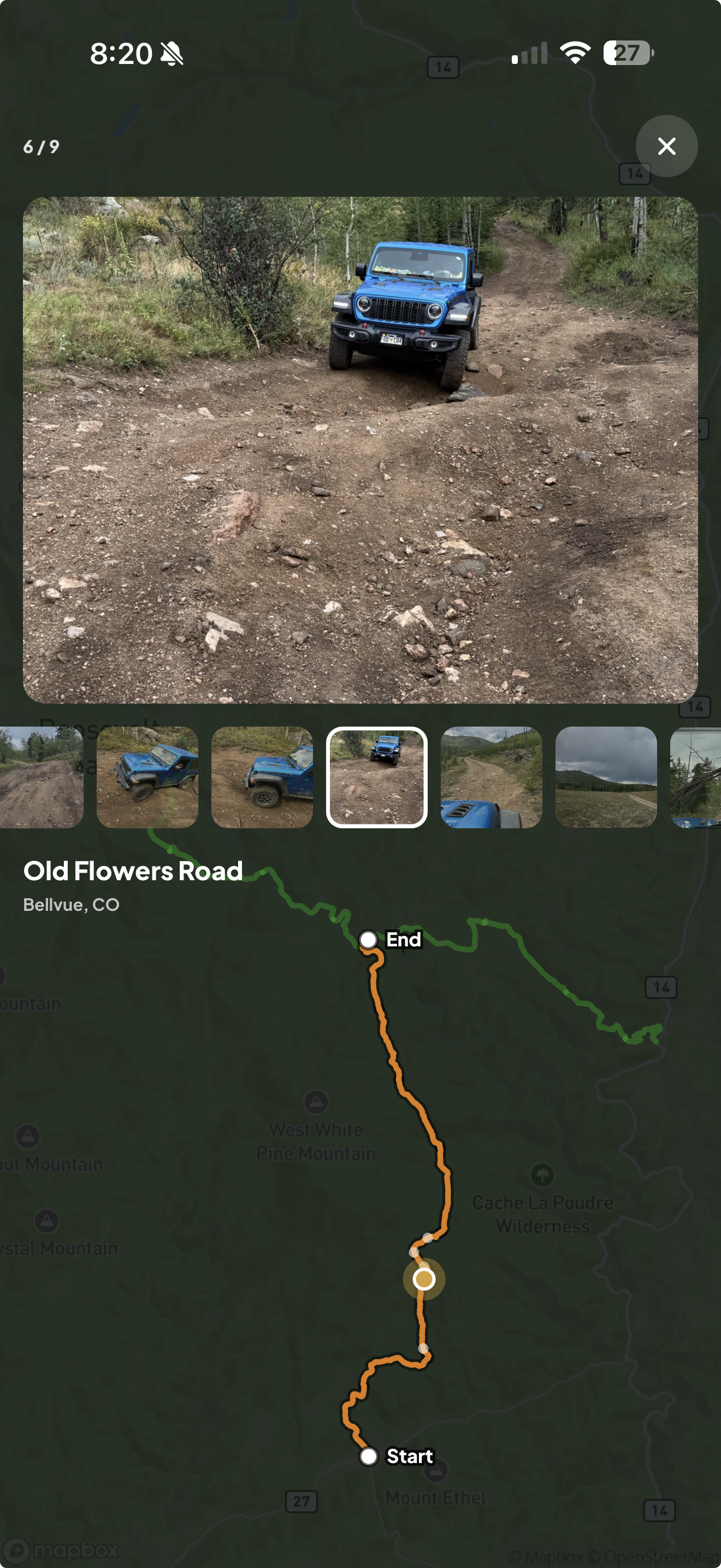
Obstacles aren't mapped once and forgotten. Every one is pinned by real GPS data from drivers on the trail, backed by the photos, videos, posts, and comments of the people who just crawled it — then named by community vote. That matters, because obstacles get pulled, re-stacked, and reshaped all the time. The shelf you crawled in May can be a winch point after one storm. Your adventure — and your safety — ride on knowing what's actually out there right now. And every obstacle is baked into offline navigation on every trail, so you're never in the dark.
Pinned by GPS — photos and video land on the exact spot they were shot
Named and confirmed by community vote — run after run
The community decides what stays, what goes, and what gets added
Screenshot 12Trail gallery map with the named obstacle listobstacle-map.png
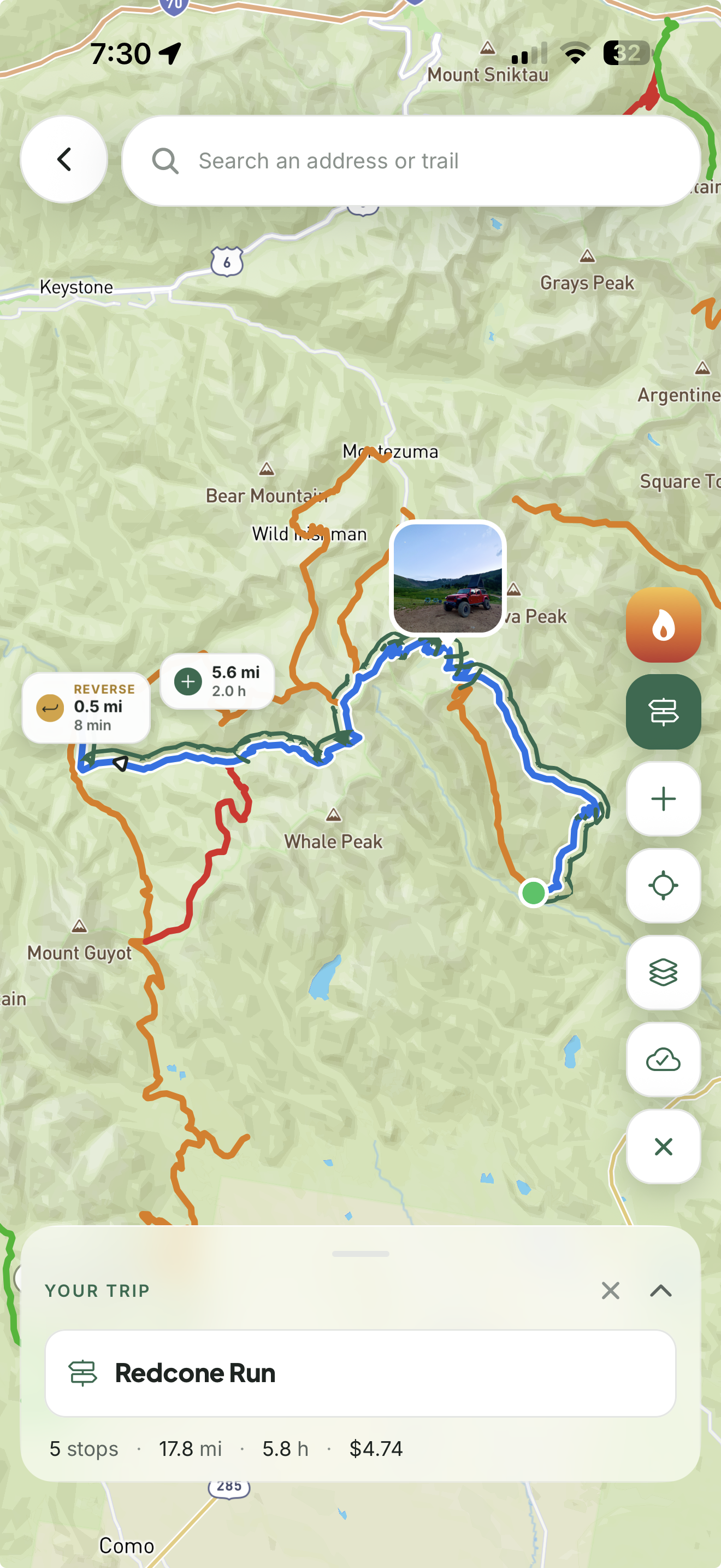
Chain as many trail legs as the trip requires with simple tap-to-add routing — live time and fuel cost estimates update as you build. Drop camps along the route, share the plan with your crew, and when you hit Run, the whole trip becomes a custom route you can follow leg by leg in 2D or 3D.
Unlimited legs across any trail type, with trails found along the way
Live time and fuel cost estimates, so a weekend fits in a weekend
Share it with the crew or run it solo — your call
Screenshot 03Planner with the full multi-leg route built outplan-build.png
The planThe whole route as you build it
Screenshot 04Run view — only your path drawnplan-run.png
Your runJust your path, nothing else
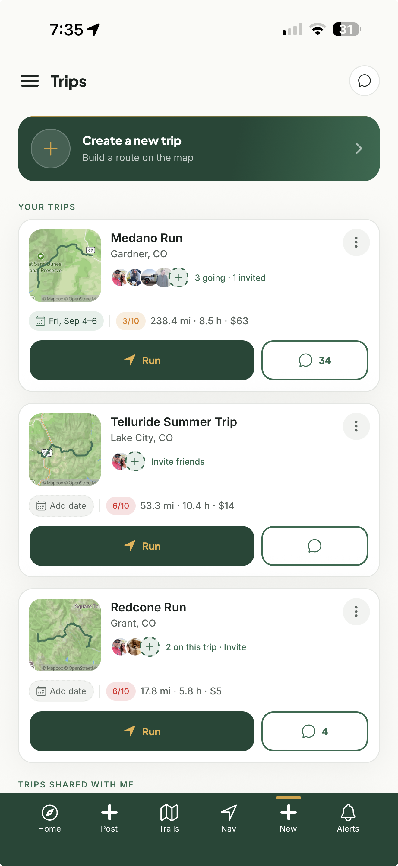
Your tripsEvery trip you've built — saved and ready to run
Screenshot 14Trips list — saved tripsplan-trips.png
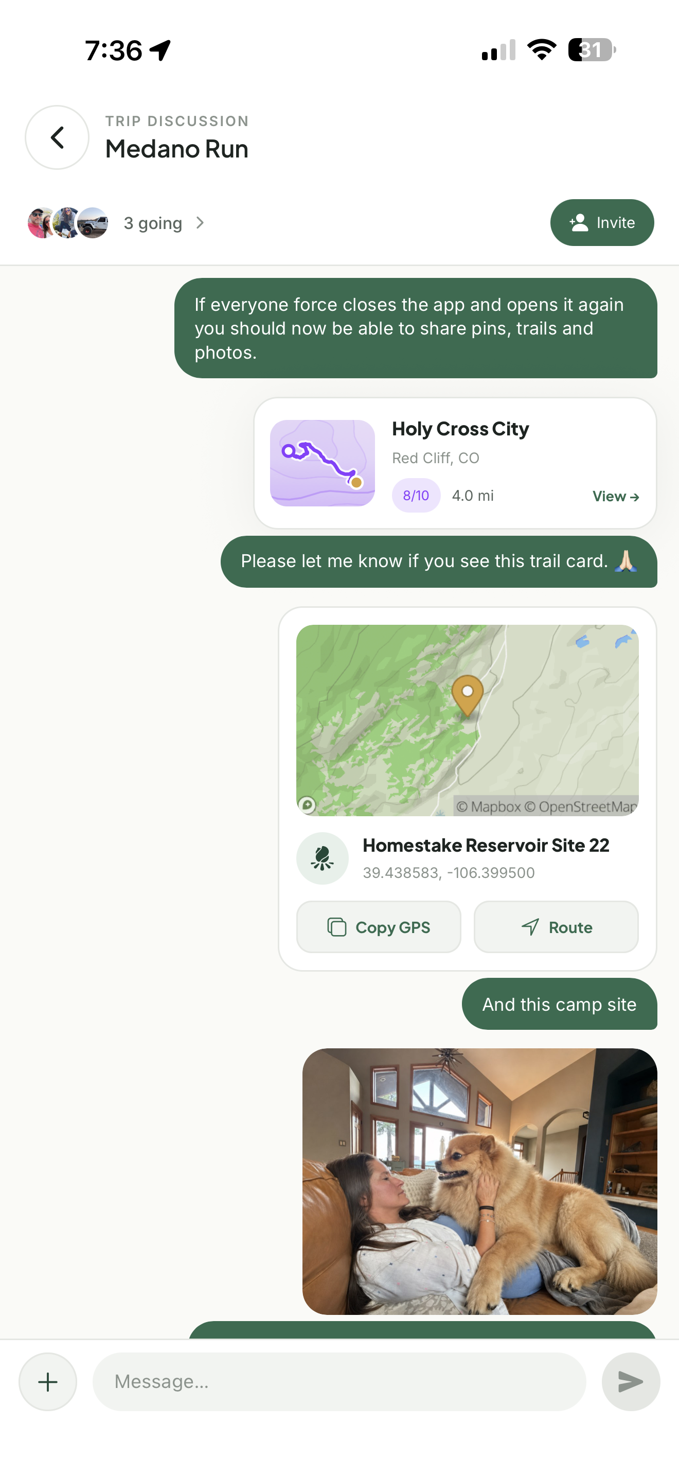
Trip chatPlan it together — one thread per trip
Screenshot 15Trip chat thread with the crewplan-chat.png
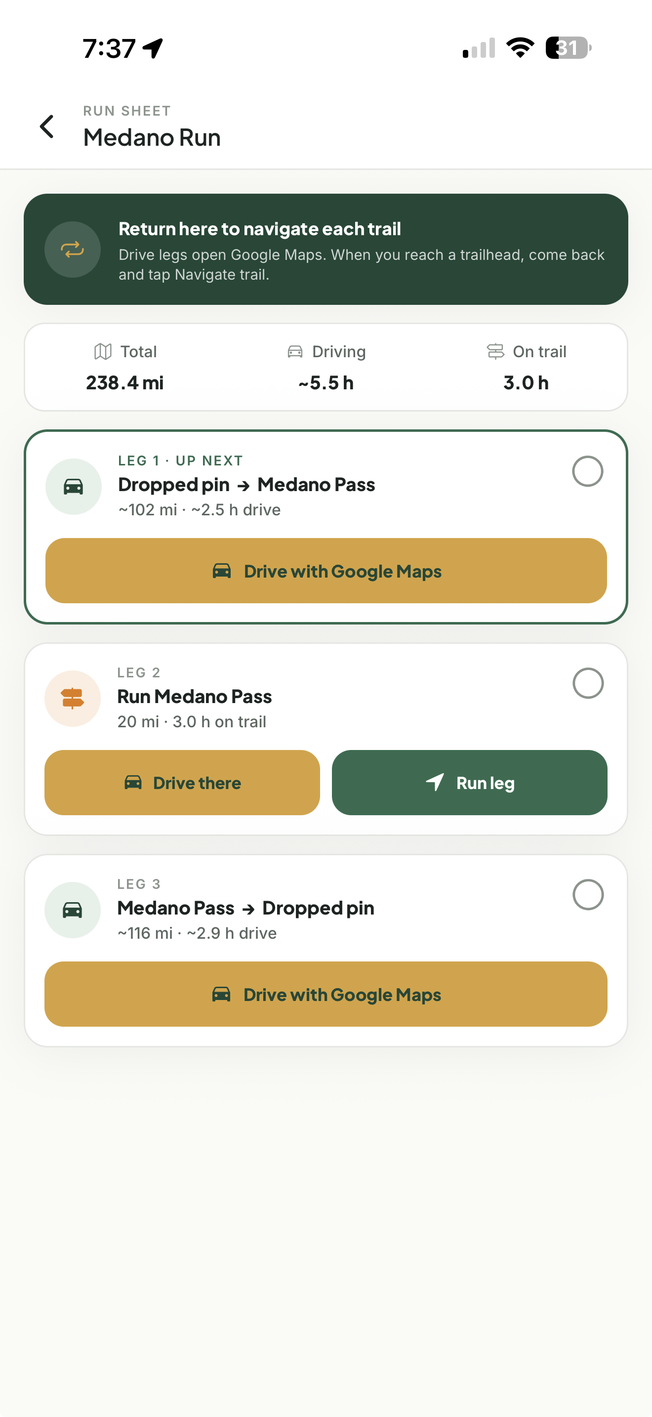
Leg navigationEvery leg turns into guided navigation, 2D or 3D
Screenshot 16On-trail navigation for one legplan-leg-nav.png
Navigate
See the terrain ahead before you’re in it.
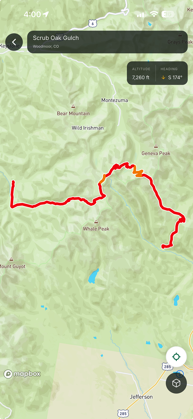
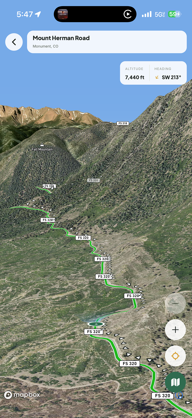
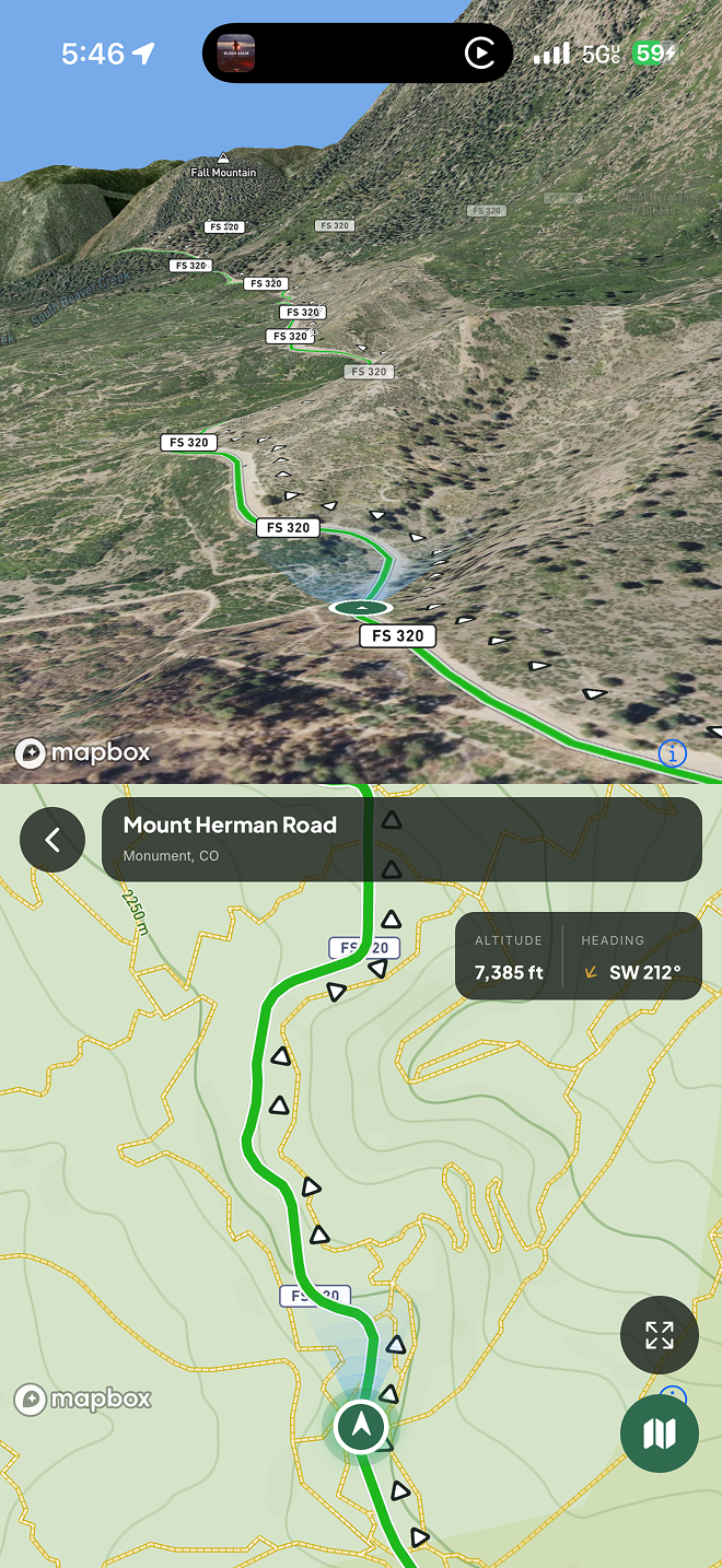
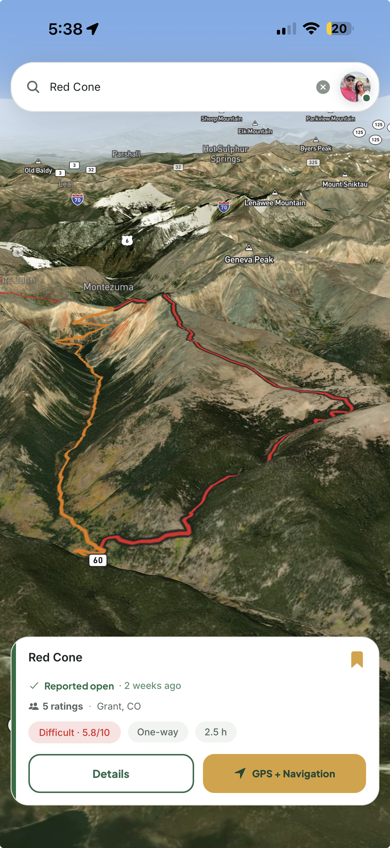
On-trail guidance that keeps working once the road stops being a road. Flip into the chase view to see the terrain ahead in 3D — the grade, the drop-off, where the trail bends around the ridge — or stay flat on topo with every leg of your run on screen. Every community-pinned obstacle shows up right on your route, and all of it works offline via map download.
Turn-by-turn on trail, leg by leg
3D satellite and terrain chase view — real elevation, not a flat line
Maps, routes, and every pinned obstacle — all available offline
Screenshot 053D chase-cam split view on trailnavigate-3d.png
Screenshot 062D topo navigation — active run with legsnavigate-2d.png
Trail reports
Stop guessing. Go look.
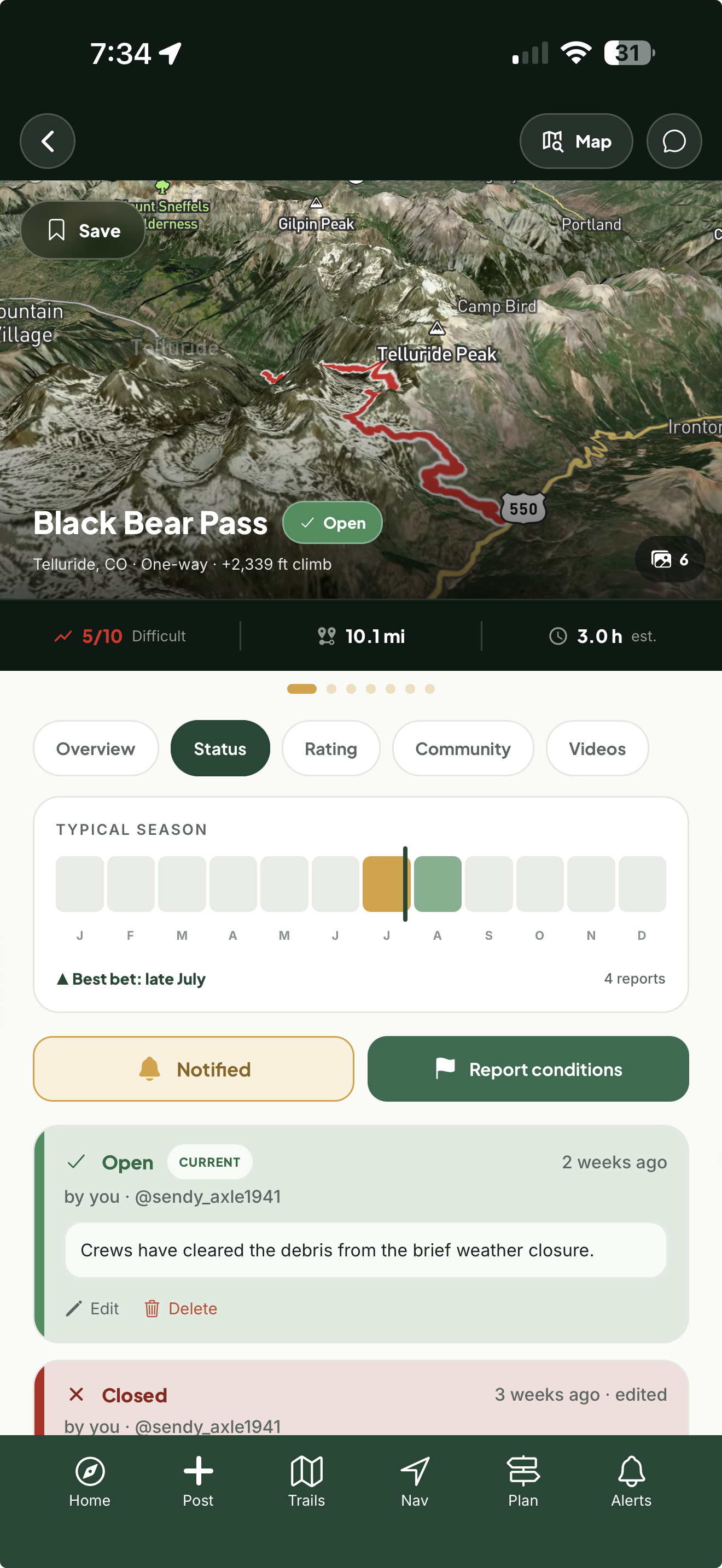
Every trail carries live conditions posted by people who were just there, plus a season strip showing when it typically opens and closes. Follow a trail and get pushed the moment its status flips — the pass opened, the creek is up, the gate's closed.
Current status from roamers who just ran it
Push alerts the second a trail's status changes
Ask in Trail Talk — answered by people who were there
Screenshot 07Status tab — season strip + condition report cardstrail-status.png
Camps
Camps found by people who wheel.
Not a campground directory. These are spots roamers actually pulled into — dropped, photographed, and tagged with what matters offroad: how many rigs fit, whether it's free or paid, power, and whether you'll have a bar of service. Keep a spot private, share it with friends, or post it public.
Community pins from offroaders who were actually there
Filter by number of rigs, free or paid, electric, and cell service
Private, friends-only, or public — your call per spot
Screenshot 08Explore map with community camp pinscamps-map.png
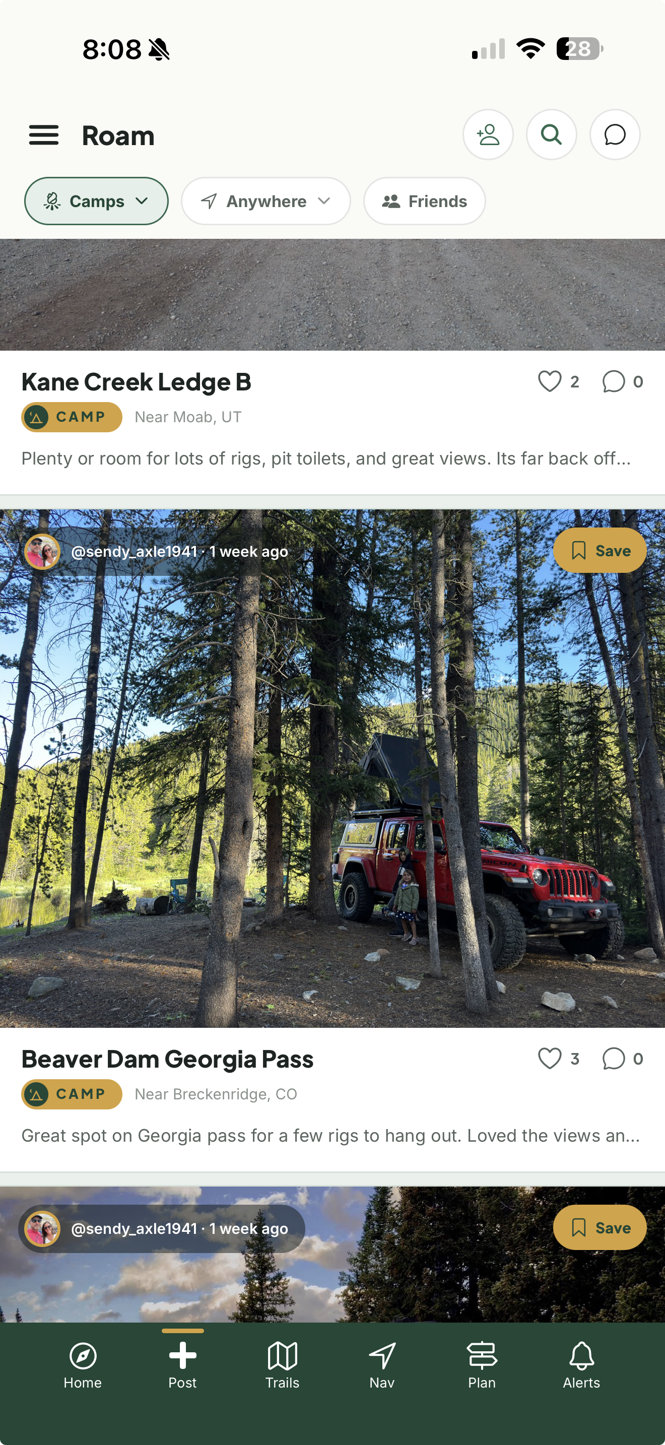
Every trail shows the actual rigs that cleared it and when. A difficulty rating is somebody's opinion — seeing three builds like yours finish it last weekend is something you can act on. Log your own runs, find roamers near you, and go wheel with them.
See the builds and tire setups that ran it
Local Roamers — who's running trails near you
Log every run with photos, notes, and conditions
Screenshot 10Roam feed / recently-run-by with rigsroam-feed.png
Screenshot 11Run log detail with photosrun-log.png
Crew chat
One thread per trip, so the plan doesn't live in six group texts.
Direct messages
DM anyone in the Roam with trail questions — answered by someone who actually ran it.
Live location
Share your location with friends — iPhone and Android alike.
Rig profile
Your build, shown on every trail you run.
Follow trail areas
Point your home feed at any area in the country and never miss the action on your favorite trails.
Follow camp areas
Watch a camping zone the same way — new spots and reports the moment they're posted.
Status push alerts
Get notified the second someone runs a trail you follow.
Rated by the community
Trails change and rigs change. Know if that 5 is really a 7 — or that 6 is really a 4.
Land ownership
BLM, Forest Service, tribal, state, or private — know whose land you're crossing.
Photos on the map
Every photo and video pinned to the exact spot on the trail it was shot.
Warnings & permits
High-consequence trails carry a warning; permit trails link straight to the agency.
Trail seasons
A season strip shows when each trail typically opens up and closes for the year.
Pricing
One price. Everything included.
No tiers, no per-state add-ons, no ads. Community-run conditions, updated the moment someone's on the trail.
Free
$0
Sign up and start exploring.
The full trail catalog and map
Trail weather and saved trails
Log runs with photos, and the Roam feed
Friends, trip-crew chat, and your own camps
Basic route building
Landroamer Pro
$29.99 / year
$2.50 a month. About half a tank of gas, for the whole year.
Live conditions & difficulty — rated by whoever just ran it
On-trail navigation in 2D and 3D
Community camps — everyone's spots, not just yours
Crew trips — invites, shared plans, and trip chat
Condition alerts and live location sharing
Satellite & 3D terrain layers, unlimited saved trips
Offline map downloads — the whole region on your phone